


PORTER 01, Porter County, Indiana
About
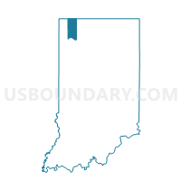
Outline

Summary
| Unique Area Identifier | 580102 |
| Name | PORTER 01 |
| County | Porter County |
| State | Indiana |
| Area (square miles) | 6.44 |
| Land Area (square miles) | 6.35 |
| Water Area (square miles) | 0.09 |
| % of Land Area | 98.56 |
| % of Water Area | 1.44 |
| Latitude of the Internal Point | 41.42692610 |
| Longtitude of the Internal Point | -87.15307700 |
Maps


Graphs
Select a template below for downloading or customizing gragh for PORTER 01, Porter County, Indiana


Neighbors
Neighoring Voting District (by Name) Neighboring Voting District on the Map
- CENTER 23, Porter County, IN
- CENTER 24, Porter County, IN
- CENTER 31, Porter County, IN
- MORGAN 02, Porter County, IN
- PORTER 02, Porter County, IN
- PORTER 04, Porter County, IN
- UNION 02, Porter County, IN
Top 10 Neighboring County Subdivision (by Population) Neighboring County Subdivision on the Map
- Center township, Porter County, IN (43,267)
- Porter township, Porter County, IN (9,367)
- Union township, Porter County, IN (8,811)
- Morgan township, Porter County, IN (3,684)
Top 10 Neighboring Place (by Population) Neighboring Place on the Map
Top 10 Neighboring Unified School District (by Population) Neighboring Unified School District on the Map
- Valparaiso Community Schools, IN (43,267)
- East Porter County School Corporation, IN (12,901)
- Porter Township School Corporation, IN (9,367)
- Union Township School Corporation, IN (8,811)
Top 10 Neighboring State Legislative District Lower Chamber (by Population) Neighboring State Legislative District Lower Chamber on the Map
Top 10 Neighboring State Legislative District Upper Chamber (by Population) Neighboring State Legislative District Upper Chamber on the Map
- State Senate District 6, IN (146,652)
- State Senate District 4, IN (141,328)
- State Senate District 5, IN (127,561)
Top 10 Neighboring 111th Congressional District (by Population) Neighboring 111th Congressional District on the Map
Top 10 Neighboring Census Tract (by Population) Neighboring Census Tract on the Map
- Census Tract 510.02, Porter County, IN (8,469)
- Census Tract 506.04, Porter County, IN (8,091)
- Census Tract 510.07, Porter County, IN (7,157)
- Census Tract 510.05, Porter County, IN (4,425)
- Census Tract 510.08, Porter County, IN (2,210)